OscarBravo992
Well-known member
Hi Everyone!
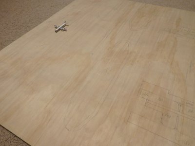
Over the past couple of weeks I've been working on a 1:400 replica of Melbourne's second airport, Essendon Feilds.
Background information:
Essendon Feilds (YMEN / MEB) was opened in 1921 and served as Melbourne's primary airport until 1970 when Tullamarine Airport (Melbourne's current primary airport) opened and took the majority of domestic and international traffic. Essendon still exists and is in use today, however it mostly sees GA traffic nowadays. I'm modelling Essendon in the pre-Tullarmarine days (before 1970) when the likes of TAA and Ansett were Australia's leading domestic airlines. Qantas occasionally served Essendon, as did international names like PanAm and BOAC.
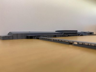
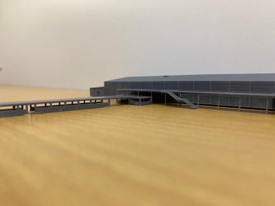
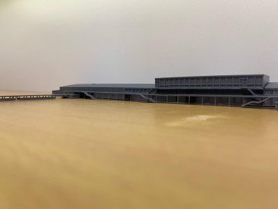
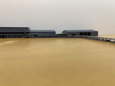
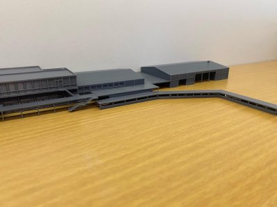
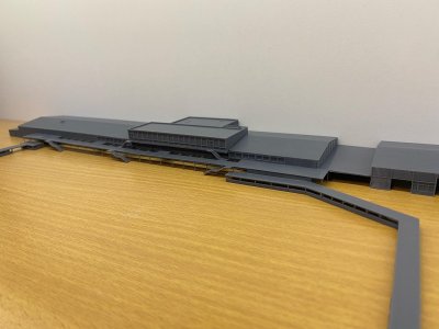
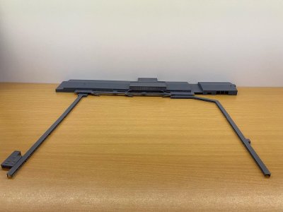
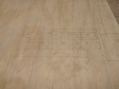
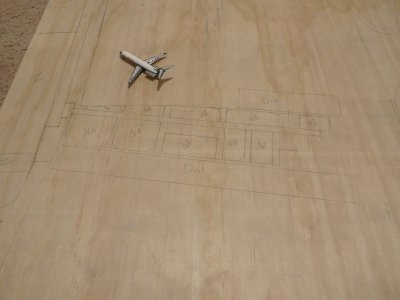
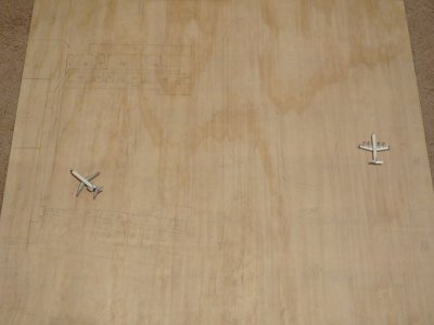
I've finished the 3D model, and I'm starting to print it.


This was my first attempt at modelling an airport building on CAD and I'm pretty happy with the result.
I'll update this thread as I go, and I'll also post more WIP photos on Instagram (Here)
Over the past couple of weeks I've been working on a 1:400 replica of Melbourne's second airport, Essendon Feilds.
Background information:
Essendon Feilds (YMEN / MEB) was opened in 1921 and served as Melbourne's primary airport until 1970 when Tullamarine Airport (Melbourne's current primary airport) opened and took the majority of domestic and international traffic. Essendon still exists and is in use today, however it mostly sees GA traffic nowadays. I'm modelling Essendon in the pre-Tullarmarine days (before 1970) when the likes of TAA and Ansett were Australia's leading domestic airlines. Qantas occasionally served Essendon, as did international names like PanAm and BOAC.
I've finished the 3D model, and I'm starting to print it.
This was my first attempt at modelling an airport building on CAD and I'm pretty happy with the result.
I'll update this thread as I go, and I'll also post more WIP photos on Instagram (Here)